NAHC at the New York Historical Society
The New Amsterdam History Center Presents its 3-D Model 'Explore New Amsterdam'
at the New-York Historical Society Installation
“New York Before New York: The Castello Plan Of New Amsterdam.”

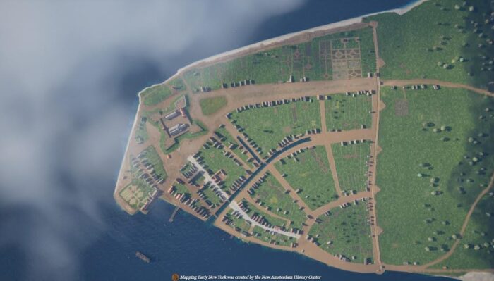
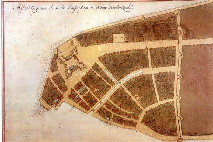
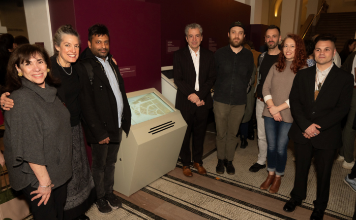
The creative team behind NAHC’s “Mapping Early New York” project, along with several invited guests and NAHC trustees, were among over 400 people who gathered at the New-York Historical Society (N-YHS) on the evening of March 20, 2024, to celebrate the opening of N-YHS’s current installation “New York Before New York: The Castello Plan of New Amsterdam.” The installation, mounted to commemorate the 400th anniversary of the arrival of the first Europeans to settle in what is now New York, is centered around the “Castello Plan,” an extremely rare depiction of the town of New Amsterdam as it existed shortly before the Dutch colony of New Netherland was taken over by British forces in 1664. The installation features NAHC’s exciting 3-D virtual model of New Amsterdam, which is a part of the “Mapping Early New York” project.
The original map on which the Castello Plan is based was created by the colony’s official surveyor, Jacques Cortelyou, in about 1660. That original (since lost) was redrawn several years later to be bound into a collection that was sold to an Italian nobleman. After over 200 more years, that later version was rediscovered in the Villa di Castello near Florence – hence the name. That second (and earliest surviving) version is on loan from the Biblioteca Medicea Laurenzina in Florence as the centerpiece of the N-YHS installation, which was curated by Russell Shorto, the director of the New Amsterdam Project, a joint undertaking between N-YHS and the New Netherland Institute (NNI). With more than a dozen other documents and artifacts, including a striking portrait of Pieter Stuyvesant, the installation explores how settlers, Indigenous people, and enslaved Africans experienced the world illustrated in the Castello Plan.

A very literal glimpse of that world is provided by NAHC’s contribution to the installation. An interactive touch screen kiosk located near the Plan allows visitors to explore a breathtaking three-dimensional rendition of the Castello Plan, providing a view of New Amsterdam as it must have actually looked in 1660. Using the virtual 3-D model, a viewer can “move” through the town, stopping to learn more at different points, such as the fort or the homes of various residents. Prominent citizens and laborers, cows and pigs, vegetable gardens and flowers — along with all of the town’s known buildings — are shown as they would have been then.
According to Toya Dubin, Project Manager of “Mapping Early New York,” the 3D interactive map, Explore New Amsterdam, was created in a year-long collaboration between staff at the NAHC’s Mapping Early New York, the New-York Historical Society, and the New Netherland Research Center. “It was a privilege to work with Russell Shorto and the team at the New-York Historical Society, and with Charles Gehring at the New Netherland Research Center to create a 3D experience that will feel authentic to visitors.”
Eduard van Dijk, the NAHC’s 3D Modeling Director explained, “Our goal was to offer visitors a sense of what life in 1660 might have been like. Crowded docks loaded with goods and traders, the original City Hall, a house where enslaved Africans lived, soldiers marching on the trail created by the Lenape that would later become Broadway, even taverns serving beer.”

“The Castello Plan is the foundation of the Mapping Early New York project, which includes a detailed Encyclopedia, thousands of original Dutch documents, many other maps, and several 3D models now including Explore New Amsterdam,” said Esme Berg, NAHC’s Executive Director. “We are so excited to see the original Castello Plan here after more than a decade of our work to promote an understanding of New Amsterdam and its inhabitants in the 17th century, before it became New York.”
Significant financial support for “Mapping Early New York” has been provided by the Robert David Lion Gardiner Foundation. Kathryn Curran, Executive Director of the Foundation, noted, “We are delighted to support projects that push the boundaries of history, culture, and the digital world. The New Amsterdam History Center’s integration of 3D models, original documents, Encyclopedia, and maps is an entirely new way to experience the past.”

Guests at the celebration included the Consul General of the Kingdom of the Netherlands in New York, Ahmed Dadou; the Cultural Attaché, Monique Ruhe, and other members of her staff; former NAHC Trustee Kenneth Chase; and representatives from other Dutch-American organizations. All were invited into the N-YHS theater for a discussion, “New York Before New York: The Dutch Impact,” featuring NNI Director Deborah Hamer, Robert Odawi Porter representing the Seneca Nation, and Russell Shorto as moderator.


