History
The Castello Plan is the earliest known “map” of New York City. The perspective bird’s-eye view was a radically novel idea in both city planning and cartography at the time. The original Plan was created in 1660 by Jacques Cortelyou (c. 1625–1693), surveyor general of New Netherland, in employ of the WIC (Dutch West India Company).
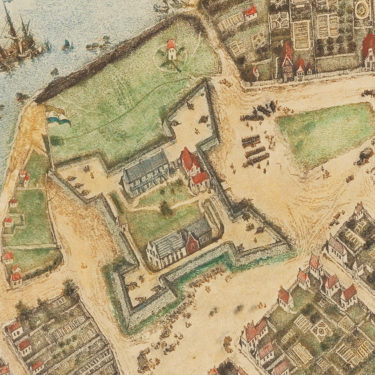
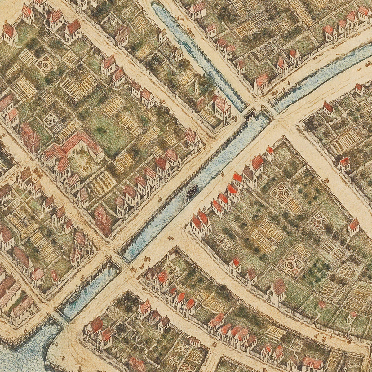
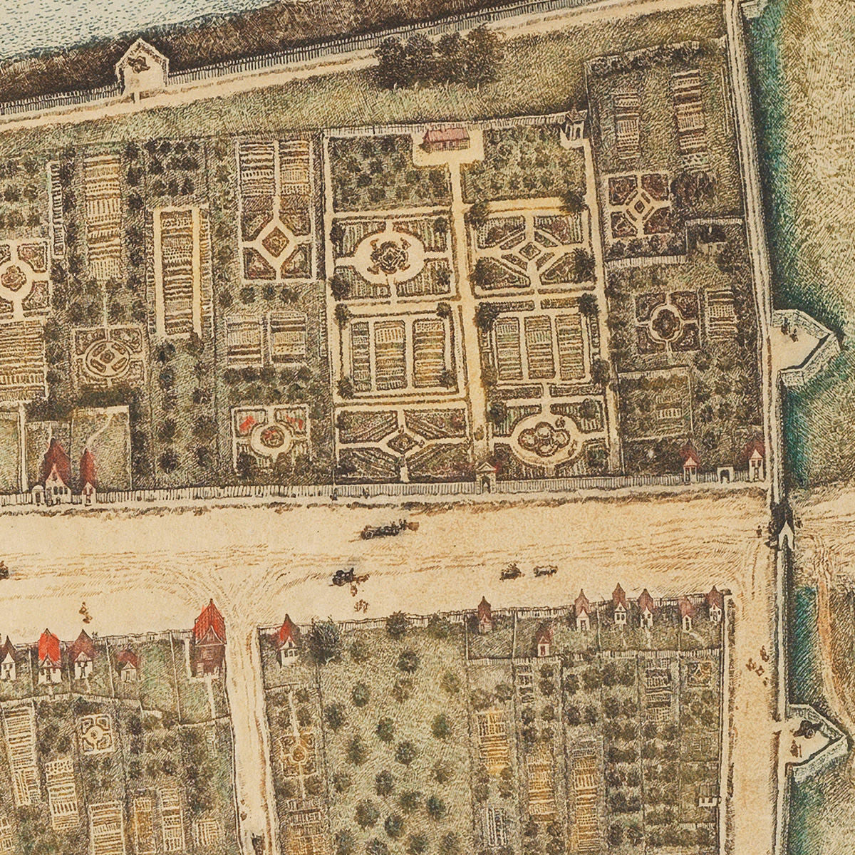
The Plan, oriented with NW at the top, contains a great deal of visual information about the walled city (today Lower Manhattan), with detailed depiction of individual buildings, streets, squares, canals, gardens, docks, Peter Stuyvesant’s house, the Wall Street wall, and Fort Amsterdam flying the DWIC flag. Ships and boats are visible in the waters surrounding Manhattan, along with several beached vessels.
Around 1667, cartographer Joan Blaeu (1596–1673) bound the existing plan to an atlas, together with other hand-crafted New Amsterdam depictions. He sold the atlas to Cosimo III de’ Medici, Grand Duke of Tuscany. This transaction most likely happened in Amsterdam, the Netherlands, as it has yet to be proven that Blaeu ever set foot in New Netherland.
It resurfaced 233 years later, in 1900, at Villa di Castello — a Medici family estate near Florence, Tuscany. So, Cortelyou’s historic map was nicknamed the “Castello Plan.” The original Plan’s title reads: “Afbeeldinge van de Stadt Amsterdam in Nieuw Neederlandt”.